Goechala Trek

Goechala Trek

Add Ons

Total Duration

10 Days

No of Trekking Days

8 Days

Starting Point / Place

Yuksom, Sikkim

Ending Point / Place

Yuksom, Sikkim

Grade

Difficult

Maximum Altitude

4,600 meters / 15,100 feet

Best Time To Visit

March-May,
October – December

Price

19500 + 5%GST

Add Ons

Overview

Goechala Trek is one of the most awe-inspiring and sought-after trekking destinations in the Indian Himalayas. Located in the Indian state of Sikkim, this trek offers a mesmerizing blend of natural beauty, biodiversity, and challenging terrain, making it a favorite among trekkers and adventure enthusiasts. Here is a comprehensive overview of the Goechala Trek. The Goechala Trek is situated in the northeastern part of India, in the state of Sikkim. It is nestled within the Kanchenjunga National Park, which is a UNESCO World Heritage Site, and offers stunning views of the third highest peak in the world, Mount Kanchenjunga. The trail starts from Yuksom, a small town in Sikkim, and leads trekkers through lush forests, pristine lakes, and alpine meadows. The trek typically spans around 8 to 10 days, covering approximately 90 to 100 kilometers, depending on the chosen route and pace. Trekkers usually spend their nights in tents or basic lodges along the route. The best time to undertake the Goechala Trek is during the pre-monsoon season (April to May) and post-monsoon season (September to November). During these periods, the weather is relatively stable, and the skies are clear, providing the best views of the surrounding peaks and landscapes. Highlights: 1. Panoramic Views: The Goechala Trek offers breathtaking panoramic views of the mighty Himalayan peaks, including Mount Kanchenjunga, Mount Pandim, and Mount Jopuno. The sunrise view from Dzongri Top is particularly famous and is considered a highlight of the trek. 2. Biodiversity: The trek takes you through diverse landscapes, ranging from dense rhododendron forests to high-altitude meadows. The region is teeming with wildlife, and lucky trekkers might spot red pandas, Himalayan tahr, and various species of birds. 3. Cultural Experience: The trek starts from Yuksom, which holds historical significance as the first capital of Sikkim. Trekkers can explore the rich Tibetan Buddhist culture of the region, with monasteries and prayer flags dotting the landscape. 4. Challenging Terrain: The Goechala Trek is a moderate to strenuous trek, and trekkers must be prepared for steep ascents and descents, rocky trails, and potentially challenging weather conditions. Physical fitness and acclimatization are essential for a successful trek. Route: The most common route for the Goechala Trek includes stops at Sachen, Tshoka, Dzongri, and Thansing before reaching Goechala Pass itself. Trekkers return via the same route or may choose to take an alternative path through Lamuney and Kockchurang. Permits: To undertake the Goechala Trek, trekkers must obtain permits from the Sikkim Tourism Department. These permits are typically arranged by tour operators, but individual trekkers can also apply for them. Safety Tips: 1. Acclimatize properly to prevent altitude sickness. 2. Pack warm clothing and rain gear as the weather can change rapidly. 3. Always book it from a professional tour operator for navigation and safety. 4. Carry a comprehensive first aid kit. 5. Follow Leave No Trace principles to protect the fragile Himalayan ecosystem. The Goechala Trek is an adventure of a lifetime, offering trekkers the chance to connect with nature, challenge their limits, and witness some of the most stunning natural beauty in the world. It’s a journey that leaves a lasting impression and creates memories that will be cherished forever. This trek also offers you some challenging and tiring days. On together you will be covering a total of 90 km and attaining an altitude of 15,100 feet.

Available Batches

March 2025

09 Mar – 18 Mar (Open)

23 Mar – 01 Arpril (Open)

April 2025

06 April – 15 April (Open)

20 April – 29 April (Open)

Brief Itinerary

Day 1

Bagdogra Airport/ NZP Railway Station to Yuksom

Day 2

Yuksom to Sachen

Day 3

Sachen to Tshoka

Day 4

Tshoka to Dzongri

Day 5

Dzongri to Thansing

Day 6

Thansing to Lamuney

Day 7

Lamuney to Thansing / Kokchurang

Day 8

Thansing / Kokchurang to Tshoka

Day 9

Tshoka to Yuksom

Day 10

Drive back to Bagdogra Airport NZP Railway station

Detailed Itinerary

Day 1 : Bagdogra Airport/ NZP Railway Station to Yuksom (5,643 ft/1,720 m),150 km 6-8 hours of drive

Max. Elevation of the day– Yuksom (5,643 ft/1,720 m)
Route Detail– Report at Siliguri and board into your respective vehicle for a long and beautiful ride to Yuksom. You’ll witness the Teesta river in between. At Melli, you’ll enter into Sikkim. Stop at Jorethangh(a small beautiful town) for the lunch. This will also be the best place to buy your essential trek leftovers. In another 3 hours, you’ll reach your destination, Yuksom. Yuksom is a small beautiful town with some monasteries, a few shops, and restaurants. Briefing, documentation, and orientation of the trek in the evening.
Highlight of the day– The route and the destination
Accommodation– Hotel
Remark– Keep your Id’s Handy as it will be checked at Melli check-post and do bring all your required documents ready.

Day 2 : Yuksom (5,643 ft/1,720 m) to Sachen (7,200 feet/2,195 m), Approx. 6 hours of trek.
Max. Elevation of the day– Sachen (7,200 feet/2,195 m) Route Detail– The initial 30 min. of the trek is through the town and on the road itself. Then the trail enters into the forest. The whole route today is a mix of ascending and descending to the campsite with so many water sources on the way. Today we’ll cross three bridges. The campsite is 20 mins, ahead of the third bridge. The campsite Sachen is having limited space and inside the forest. Overnight stay in the tents. Highlight of the day– The Route Accommodation– Tents
 
Day 3 : Sachen (7,200 feet/2,195 m) to Tshoka (9,701 ft/2,957 m), Approx. 5-6 Hours of trek.
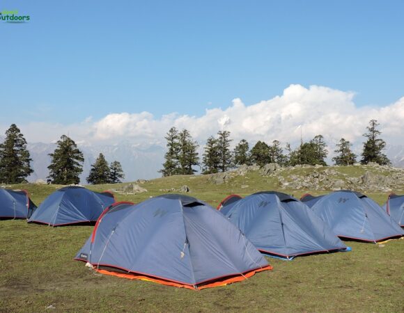
Max. Elevation of the day– Tshoka (9,701 ft/2,957 m) Route Detail– The Initial 1 hour of the trek till the last bridge is a mix of ascent and descent. The bridge is on the Prek river. After that, the trek is all the way up to Tshokha with Bakhim in between. Today also the whole route is through the forest. Mt. Pandim is visible from the campsite. Tshokha has a couple of forest huts, a small lake, and a monastery. It’s a nice campsite with a wide-open view of the whole surroundings. Overnight stay at the camp. Highlight of the day– The campsite Accommodation– Tents/ Forest Huts Remark– There will not be any water source of water in between.
 
Day 4 : Tshoka (9,701 ft/2,957 m) to Dzongri (13,024 ft/3,970 m), Approx 7 hours of trek.
Max. Elevation of the day– Dzongri (13,024 ft/3,970 m) Route Detail– Start your day o time don’t be late as today is one of the toughest days of the trek. The route is all the way up from the Thsokha itself. Today you’ll have a wooden trail (which looks very beautiful) till Phedang, the lunch point. After that, there will be a very steep ascent of 1.5 hours till Devarali top. The view from the top will vanish your tiredness within a fraction of a second. You’ll see a panoramic landscape in front of you with the first glimpse of Mt. Kanchenjunga with all its surrounding mountains. Click photos, enjoy the view and move towards the destination. The route from here is a mix of ascending and descending. You’ll reach the campsite in around 1.5 hr. After reaching the camp, going for an acclimatization walk is a must. Don’t skip that as today the height gain is 1000 mtr. Overnight stay in the tents. Sleep early as tomorrow you’ll have to wake up early for Dzongri top sunrise. Highlight of the day– View from Devrali Top Accommodation– Tents/ Forest Huts Remark– Carry atleast 2 ltr. Of water as there are very few source of water. Today we gain around 1000 m. be very careful with you nutrition, Hydration and rate of Ascent.
 
Day 5 : Dzongri (13,024 ft/3,970 m) to Thansing (12,946 ft/3,946 m), Approx. 6-7 Hours of trek.
Max. Elevation of the day– Dzongri (13,024 ft/3,970 m) Route Detail– Today will also be a long day. You’ll have to up early in the morning and trek for about 1.5 hours till Dzongri top. This will be a steep and windy walk. The sunrise from the top will be an experience for a lifetime. The whole show is just phenomenal. You’ll get to see 16 Himalayan peaks from the top. Mt. Kanchenjunga, Pandim, Kabru south, Kokthang, Frey, Fork, Tenzingkhang are few of them. After clicking, photos and videos descend down to the campsite for breakfast and then get ready to move to the next camp. The route till thansing starts with an initial 30 mins. of steep ascent and then gradual walk for about 2 hours till a point from where the route transforms into a very steep ascent for about 1.5 hours. The descend finishes at Kokchurang. The place is just along the river and will be our lunch point. The campsite from here is another 1.5 hour of the walk which will be a gradual ascend through a jungle. Reach Thansing by late afternoon. This place is a wide-open meadow. Mt. Pandim looks amazing from this place. Rest and relax as today was a long and tiring day. Overnight stay at the tents. Highlight of the day– The route and the campsite. Accommodation– Tents/Forest Huts Remark– Do carry a tripod for capturing the time-lapse and be very careful while the steep descent.
 
Day 6 : Thansing (12,946 ft/3,946 m) to Lamuney (13,650 ft/4,161 m), Approx. 2 hours of trek.
Max. Elevation of the day– Lamuney (13,650 ft/4,161 m) Route Detail- Today will be the easiest day of the trek. Start late from the camp as the distance is only 4 km. and you’ll reach the campsite in 2 hours. You will get some very amazing views, a giant view of Kanchenjunga and Mt. Pandim throughout the trail. Rest, relax and have early dinner as tomorrow will be the summit day. Pack your summit bag at the night itself so that you won’t miss anything and will get ready on time. Overnight stay at the camps. Highlight of the day– The route and the campsite. Accommodation– Tents/Forest Huts
 
 
Day 7 : Lamuney (13,650 ft/4,161 m) to Thansing (12,946 ft/3,946 m)/ Kokchurang (12,000 ft/3,659 m) Via View Point 1 ( 15,100 ft/4,602 m), Approx. 10 hours of trek.
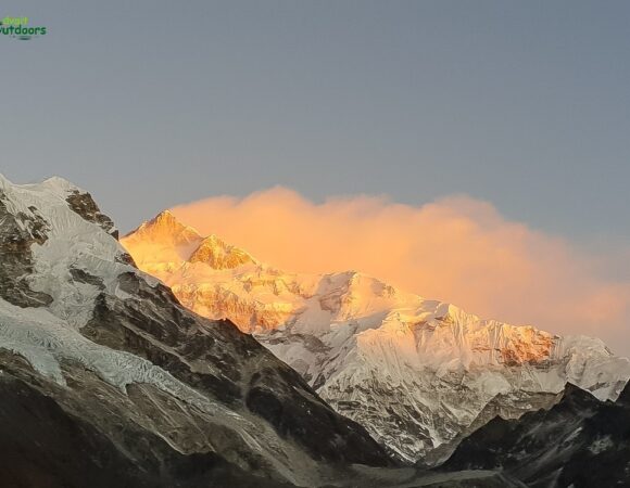
Max. Elevation of the day– Via View Point 1 ( 15,100 ft/4,602 m) Route Detail– Today you’ll go to witness what you have traveled so far. Wake up in the night, get yourself ready, have some light meals and start the trek. The initial part of the trek is a gradual than steep ascent for about 45 mins. till Samiti lake then another steep ascent for about 1.5 hours till Viewpoint 1. Enjoy the magical show of sunrise with golden-colored Khangchendzonga. Click photos make videos and return back to the camp. Wind up the camp and move to Thansing/Kokchurang. (the destination will depend upon the speed of the group). Rest and relax at the camps. Highlight of the day– Sunrise and Panoramic view from the View Point 1 Accommodation– Tents/Forest Huts Remark– Longest day of the trek. Check your head-torch batteries a day before. Reach view point 1 before the sunrise.


Day 8 : Thansing (12,946 ft/3,946 m)/ Kokchurang (12,000 ft/3,659 m) to Tshoka (9,701 ft/2,957 m), Approx. 7-8 hours of trek.
Max. Elevation of the day– Thansing (12,946 ft/3,946 m) Route Detail– Today you’ll return to Phedhang via a different route and after that descend back from the same route till Tshoka. The route from Kokchurang to Phedang is a jungle trail that is a mix of up and down. This stretch is very long and tiring also. Have your pack lunch at Phedang and reach the camp by late afternoon. Today you’ll have a much better sleep because of the low altitude. Overnight stay at camps. Highlight of the day– The Route Accommodation– Tents/Forest Huts Remark– Very few water source


Day 9 : Tshoka (9,701 ft/2,957 m) to Yuksom (5,643 ft/1,720 m), Approx. 6 hours of trek.
Max. Elevation of the day– Tshoka (9,701 ft/2,957 m) Route Detail– Start your day early so that you reach Yuksom on time and have enough time to bathe and refresh. The trail today is all the way down till the 4th bridge via Bakhim. Then a steep ascent for about 20 mins. Afterward, the trail is a mix of ascending and descending, crossing the three bridges. You’ll reach Yuksom by afternoon. Enjoy the luxury of the Hotel. Spend the evening exploring the market do buy some souvenirs (postcards, prayer flags, etc.). Enjoy the exotic dinner and do try the local millet beer, Tongba. Accommodation– Hotel Remark– Do not rush/ run in the mindset of reaching the Yuksom early. In mountain most of the accidents happens during descend.
 
Day 10 : Drive back to Bagdogra Airport NZP Railway station
Start your journey early so that you reach NJP on time. The trip ends here. Return home with loads of sweet memories.
 

Inclusions

Exclusions

Packing List

Ensure a smooth adventure with our comprehensive Packing List. From essential gear to personal items, we’ve got everything covered. Prepare efficiently for your outdoor journey, so you can focus on enjoying the experience with Advait Outdoors.

For complete details, click on this link

Frequently Asked Questions

What is the best time to do the Goechala Trek?

The best time for the Goechala Trek is during March to May (spring) for vibrant rhododendron blooms and October to December (autumn) for clear views of the Himalayan peaks, including Mt. Kanchenjunga.

How difficult is the Goechala Trek?

The trek is considered moderate to difficult, requiring good physical fitness. It involves long trekking hours, steep ascents, and high-altitude conditions, with a maximum altitude of 16,207 feet.

What kind of gear or equipment is needed for the Goechala Trek?

Trekkers need sturdy trekking shoes, warm clothing, rain gear, a backpack, trekking poles, water bottles, a sleeping bag, and a personal first aid kit.

What is the duration of the trek?

The Goechala Trek typically takes 9-11 days, covering approximately 90 km, depending on the itinerary and acclimatization requirements.

What are the food and accommodation options during the trek?

Meals are provided by trekking operators, and accommodations include tents and basic lodges/teahouses. Carry lightweight snacks like nuts, energy bars, and chocolates to stay energized during long trekking days.
Why Advait Outdoors?

Cancellation & Refund Policy

If it becomes necessary to cancel your trip, you must notify Advait Outdoors immediately in writing. Once we receive your notice, the cancellation will take effect.

Please note that the following charges will apply to cancellation:

In the rare event of the Trip (Trek/Expedition etc.) cancellation from our side, we’ll follow the below mentioned policy: We almost never cancel our Trip (Trek/Expedition etc.). But there are many variables beyond our control like {weather condition,landslides, road condition and any other “force measure condition” or unexpected political unrest, curfews, local riots, government orders, unexpected global health issues} due to which we have to cancel the Trip (Trek/Expedition, etc.) under such circumstances Advait Outdoors will refund 50% of the total amount of the trip or issue a voucher (valid for one year) for the full amount of your Trip (Trek/Expedition, etc.).

Note: All cancellation refunds will be processed back to the bank account or the credit card account from which the Trip fee has been paid

Related Treks

Testimonials & Reviews

Book Now